Derin Images

Check out some of Dazz's favourite photos at http://www.derinimages.com/


Tuesday, August 26, 2008

The Tasman Peninsula

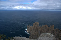
We had a massive driving day on Friday – all the way from Bicheno to Port Arthur! It took all day, but we did stop for a walk up to the lookout in Bicheno, and then lunch and a walk in Swansea on the way. We’ve decided to bypass Maria Island for the time being, and hope to come back mid-summer when the days are longer (to make the most of the price of the ferry over). The promise of a few days in a row of sunny weather spurred us on towards the Tasman Peninsula and all the cliff edge walks that awaited us there.

Saturday we did Cape Raoul and really had a mix of weather. It was breezy – not really windy, but enough to keep pushing the clouds through all day. We even had a brief shower of rain on our way back. Fortunately there were a few patches of sun to keep the photographer happy.


On Sunday we walked to Waterfall Bay and once again waited patiently for the sun to come from behind the clouds for photos. In the afternoon we went to Eaglehawk Neck and the Coal Mine Historical Site for our first taste of convict ruins. A really sad part of our history. (We'll do Port Arthur in December when we come back down here with the family.)


The last two days have been mostly spent inside marking. Today it’s been showery, which has made staying inside a lot easier. The next two days are supposed to be clear, so there are more walks on the agenda. Stay tuned for more cliff edge photos!!
Friday, August 15, 2008

Another mountain... almost

Wednesday morning broke clear and sunny. 'Let's go!', 'Gotta make the most of a sunny day!', 'It might not get any better' and other such phrases were heard, and off we went.

By the time we got to where the walks started a few fluffy clouds had started to appear, and there was a bit of a breeze. By the time we were three quarters of the way up (that's 350 metres almost straight up) it was windy and the clouds were growing ominous on the other side of the bay. Once again the 'walk' involved scrambling over rock, only this time it was granite, and that means very, very slippery when wet...

The lead climber kept saying 'I'm not sure if you'll get up this bit', but the expedition coordinator did keep clambering and scrambling up. At about 350m it was a bit steep and a bit windy, so it was agreed the lead climber would go for the summit (with camera) and the coordinator would wait. A time limit of 30 minutes was set (but no clear instructions were given as to what should occur if lead climber had not reappeared by said time...).

At 35 minutes she started yelling, and a few minutes later he started yelling back. Success!! Unfortunately the prescribed time limit wasn't quite enough to go around to the Wineglass Bay side of the mountain, so the photo is of Coles Bay instead.
After sitting, waiting for half an hour the coordinator was rather cold, so a hasty retreat was made down the mountain so lunch could be eaten in the relative warmth of the car.
Since the expedition had only taken half of the day we stopped at Sleepy Bay on our way home. The clouds had started to clear (probably would have been beautiful views of Wineglass Bay!) so we had a nice afternoon wandering around taking photos there.

Tuesday, August 12, 2008

Wineglass Bay

'Frost then sunny' is our favourite weather forecast! That's what yesterday was and it was another picture postcard day of walking. The winter sun is low in the sky so even middle of the day shots are a bit shadowy, but at least there aren't so many other people around.

I wasn't feeding the wildlife, but he looked like he'd been fed before, so I put my hand out for him to sniff and was rewarded with a photo. I'm sure Dazz will put more photos on his album when he's had a play with them. The next 'frost then sunny' day is Friday, so we're hoping to do Mount Amos, which is just behind the lookout for Wineglass Bay, but about twice the height. Stay tuned for more photos...

Sunday, August 10, 2008

The Freycinet Peninsula

We've torn ourselves away from the Bay of Fires, only because there are more walks further south that we want to do before our next lot of marking starts. We're staying at Moulting Lagoon, and even though we did get a very pretty sunset the first night, it doesn't really compare to the Bay of Fires.


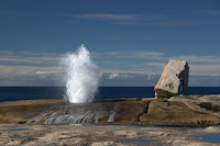
Yesterday started off overcast but fined up nicely so we went to Bicheno (The Blow Hole) and also had a look at Friendly Beaches and Cape Tourville. We're saving the Wineglass Bay walk for another cloudless day, which may be tomorrow.

Friday, August 1, 2008

What a difference the weather makes...


… especially to the sea. A few fronts and a bit of wind and our crystal clear perfect little waves turned into washing machine suds! We walked up on top of the little headland and watched the waves pound in. There’s just something about waves…


The weather made a huge difference to our experience of The Blue Tier, too. It’s a small (by Tassie standards) mountain range just west of St Helens. The first day we went up was cloudy and the wind was blowing off the snow on not-too-distant Ben Lomond. We dressed for the occasion and really enjoyed our walk. The diffuse light through the cloud was great for photos of the lichens and sphagnum moss bogs.


The next day was sunny so we went back to do some different walks. The night had been clear so it was still a bit frosty when we started out. Unfortunately the air was a little hazy, so panoramas weren’t inspiring to the photographer.


There’s a coral-like lichen on the mountains around here which is supposedly know as east coast snow. We decided ‘mountain coral’ was a more appropriate name.


Remnants of tin mining on the tier… is this what our old Jackaroo has to look forward to???